
Neumark/East Brandenburg/Ziemia Lubuska
Neumark/East Brandenburg/Ziemia Lubuska
Etymology
The place names ‘Neumark’, ‘East Brandenburg’ and ‘Lebuser Land’ should not be regarded as synonyms, as they refer, on the one hand, to different historical contexts and, on the other, to the region under discussion here within different geographical boundaries.
The name commonly used for the region today is Ziemia Lubuska (Lebuser Land) and refers to the area within the administrative boundaries of the Lubusz Voivodeship (Polish: Województwo lubuskie). It refers to the Diocese of Lebus/Lubusz, which existed from 1124/1125 to 1555.
The Neumark, as a historical region east of the middle Oder, has its origins in the 13th century. During the period of Brandenburg’s expansion, it was originally referred to as terra trans Oderam or terra transoderana (Latin for ‘land beyond the Oder’). The name Nova marca (Latin for ‘New Mark’) appeared in the 14th century. Following the Altmark and the Mittelmark, the Neumark thus became the border province of the Mark Brandenburg.
East Brandenburg is not a historical region. The term refers to the parts of the Prussian province of Brandenburg lying east of the Oder and the Lusatian Neisse (Nysa Lużycka), which became part of Poland in 1945.
Location
The Neumark region is bounded to the west by the River Oder. The southern boundary of the Neumark in the strict sense (excluding territorial expansions and cessions from 1248 onwards) is defined by the lowerWarta and theNoteć, whilst the eastern boundary is defined bythe Drawa. The northern border with Pomerania ran south of a line fromReetz/Recz to Stargard/StargardSzczeciński to Szczecin/Szczecin. Today, the Neumark is divided between the West Pomeranian Voivodeship (Województwo zachodniopomorskie) and the Lubusz Voivodeship.

The area known as East Brandenburg comprises the parts of the Neumark (in the broader sense) that belonged to Brandenburg until 1945, as well as the adjoining area to the south, east of the Lusatian Neisse and north and south of the Oder. The East Brandenburg region thus largely corresponds to today’s Lubusz Voivodeship, excluding theLower Silesian area around Grünberg/Zielona Góra.
The Diocese of Lebus stretched across both sides of the middle Oder and the present-day national border. The part situated west of the Oder, with the administrative centres of Lebus, Fürstenwalde and Beeskow, has been regarded as part of the Brandenburg Mittelmark since the 14th century. The areas on the eastern bank were assigned to the administrative centre of Lebus and have also been referred to since 1313 as the ‘Sternberg region’ (Ziemia Torzymska), and presumably from the time of Johann von Küstrin (1513–1571) as incorporated parts of the Neumark.

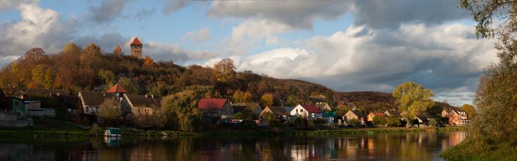
The Lubusz Voivodeship, in central-western Poland, comprises 12 counties and the two cities with independent municipal status: Landsberg an der Warthe/Gorzów Wielkopolski and Grünberg. The two counties of Zielenzig/Sulęcin and Frankfurter Dammvorstadt/Słubice, together with the municipalities of Lagow/Łagów, Vietz (Ostbahn)/Witnica and Küstrin/Kostrzyn largely correspond to the Sternberg region, or rather the part of the historic Diocese of Lebus that is now in Poland. They extend southwards from the Warta River valley. The neighbouring districts to the north – Landsberg an der Warthe and Friedeberg (Neumark)–Driesen/Strzelce Krajeńskie–Drezdenko – correspond to the south-westernmost part of the historical Neumark in the narrower sense. The province also includes the districts of Crossen/Krosno Odrzańskie and Schwiebus/Świebodzin; to the east, the historically Greater Polish districts of Meseritz/Międzyrzecz and Fraustadt/Wschowa; and to the south, the three historically Lower Silesian districts of Grünberg, Neusalz/Nowa Sól and Sagan/Żagań, as well as the Lower Lusatian district of Sorau/Żary.

Topography
As part of the North European Plain (also, less accurately, referred to as the North German Lowlands), the advance and retreat of the Ice Age glaciers in the region under consideration have created a natural landscape with a great variety of geomorphological features. Watercourses are the defining elements of this landscape. Two glacial valleys run from east to west through the centre of the region. The southern Warsaw–Berlin glacial valley is traversed by the River Oder. To the north lie the vast plains of the Warta and Netze floodplains. In 2001, the strictly protected Polish Ujście Warty National Park was established on 8,074 hectares of this area, primarily for the benefit of European birdlife.
Situated centrally between the two glacial valleys, within the mesoregions of the Lubusz Lake District (Pojezierze Lubuskie) and the Torzym Plain (Równina Torzymska), lies the Torzym region. Bordered on all sides by the rivers Oder, Warta and Obra, it forms a topographical unit. The landscape north of the Warta and Neisse lowlands – that is, within the Neumark in the narrower sense – includes, amongst others, the mesoregions of Równina Gorzowska and Pojezierze Myśliborskie, and already forms part of the foothills of the Pomeranian Lake District. South of the Oder, the Neisse and Bober (Bóbr) rivers divide the plateaus. The landscape is characterised by agriculture and tourism. 49 per cent of the area of the Lubuskie Voivodeship is forested and just under ten per cent is covered by lakes. The lakes are mainly rill lakes, with a smaller number of glacial dead-arm lakes and anthropogenic lakes. There are over 500 lakes in total. In various places, there are very steep river and lake banks. The moraines and sandurs reach up to 226 metres above mean sea level.
Historical Geography

With the Christianisation of Poland in 966 under Duke Mieszko I (reigned 960–992) of the Piast dynasty, the territory became part of a larger realm for the first time. Mieszko I’s efforts to extend his power further north and west, including into the lands west of the Oder inhabited by various Slavic tribes, were continued by his successors. In 1124/1125, the Duke of Poland, Bolesław the Crooked-Mouthed (1085–1138), had previously accommodated the territorial expansion plans of Emperor Henry V (d. 1125) by establishing the Diocese of Lebus, which was placed under the authority of the Polish Archdiocese of Gniezno, in order to remove the area from the sphere of influence of the Emperor and the Archdiocese of Magdeburg. Following Bolesław the Crooked-Mouthed’s death, the Silesian Piasts ruled the Lebus region, which had now been part of Silesia for 111 years. In 1248/1249, it was ceded by Duke Bolesław II (c. 1217–1278) to the Archbishop of Magdeburg for the financing of a Silesian civil war. The Margraviate of Brandenburg, which had grown in strength during the second half of the 13th century, subsequently gained increasing influence in the region until the ruling Ascanian dynasty finally took over the territory of the Diocese of Lebus in 1287 as its sole secular rulers; the diocese remained under the authority of the Archdiocese of Gniezno until 1424. As a result of the Reformation, it was secularised and dissolved in 1555.
Following the extinction of the Ascanian ruling dynasty, the Margraviate of Brandenburg entered a period of political and economic instability under the rule of the Wittelsbachs and Luxembourgs, which lasted from 1320 to 1415. In 1402, the Neumark, excluding the Sternberg region, was pledged by King Sigismund of Luxembourg (1368–1437) to the German Order; in 1429, it passed into the Order’s possession. When the Hohenzollerns took power in Brandenburg in 1412–13, they succeeded in gradually restoring peace to the region and re-establishing central authority. In 1455, Brandenburg severed the Neumark’s ties to the State of the Teutonic Order. Towards the end of the 15th century, further territorial gains were made east of the River Oder with the duchies of Crossen and Züllichau/Sulechów.

From 1535 to 1571, following the partition of Brandenburg, the Neumark was an independent territory. For over two centuries thereafter, the Neumark retained a special administrative status within Brandenburg, as it had its own independent military and estates chamber as well as its own church administration. This came to an end with the new administrative reorganisation of Prussia following the Congress of Vienna in 1815. The districts of Dramburg/Drawsko Pomorskie and Schivelbein/Świdwin, as well as the northern parts of the district of Arnswalde/Choszczno, were assigned to the Province of Pomerania. The larger part of the Neumark, together with Lower Lusatia, was incorporated into the newly created Frankfurt administrative district, which encompassed the eastern half of Brandenburg. Following the dissolution in 1938 of the Province of Posen-West Prussia —which had been formed in 1922 from the peripheral parts of the provinces of Posen and West Prussia that had remained German—the districts of Schwerin (Warthe)/Skwierzyna and Meseritz/Międzyrzecz, as well as the northern part of the district of Bomst/Babimost; in return, the historically Neumark districts of Arnswalde and Friedeberg were transferred to the Province of Pomerania.
As a result of the Second World War, all the territories east of the Oder and Neisse rivers that were part of Brandenburg at that time – and which have since been referred to as ‘East Brandenburg’ – became part of Poland. An administrative unit known as‘Ziemia Lubuska’, with its capital at Landsberg, was established in this area; although it was subordinate to the Poznań Voivodeship (Województwo poznańskie), it enjoyed a special administrative status. In 1950, this was transformed into the Zielona Góra Voivodeship (Województwo zielonogórskie), incorporating seven Lower Silesian districts. In the north, two further Neumark districts, Königsberg (Nm.)/Chojna and Soldin/Myślibórz, were incorporated into Pomerania. This thus marks a continuation of the southward shift of the region under discussion here, a process that had been ongoing for several centuries.
As part of a further administrative reform in 1975, the region was divided into two smaller voivodeships – Zielona Góra and Gorzów nad Wartą (Województwo gorzowskie). Finally, in 1998/1999, the Lubusz Voivodeship was established in its present form, which largely corresponds to the borders of 1950 and, to a large extent, to those of Eastern Brandenburg.


Prehistory
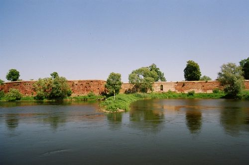
Numerous archaeological finds provide evidence of continuous settlement since the Middle Stone Age, as well as the intermingling of different cultures in this region. There are rich finds from the Bronze Age relating to the Lusatian culture, including a bronze ritual chariot near Drossen/Ośno Lubuskie. Slavic tribes migrated into the area during the 7th century. The most remarkable site from this period is the so-called ‘Polish Troy’ in Zantoch/Santok. The castle complex, situated at the only possible crossing point over the marshlands at the confluence of the Warta and Netze rivers, was destroyed and rebuilt on numerous occasions.
Middle Ages

Following its conquest by the Piast Duke Mieszko I, the region along the middle reaches of the Oder was Christianised from the 10th century onwards. In the year 1000, Gniezno, the seat of the Piasts, became an archdiocese; further dioceses were established in Kraków, Wrocław, Kołobrzeg and, finally, Lebus (1124/25).
Due to its location, the territory of the Diocese of Lebus was repeatedly the scene of border conflicts; from the mid-13th century onwards, these also involved the secular power of the Brandenburgers and the ecclesiastical power of the bishops. Even before the diocese passed into Brandenburg’s hands, German-speaking colonists had established themselves throughout the territory of what would later become Eastern Brandenburg. They were brought to the region by, amongst others, the Knights Templar, based in Quartschen/Chwarszczany, and contributed to the region’s agricultural development. To counter the bishops’ claims to supremacy, the Margraves of Brandenburg promoted the development of the town of Frankfurt (Oder), situated ten kilometres south of Lebus, which was granted town privileges in 1253. Further towns were founded in accordance with Magdeburg law. Among the most significant were the town of Landsberg an der Warthe, favourably situated for trade, and the ancient castellany of Zantoch. In addition to orders such as the Templars, the Knights of St John and the Cistercians, prominent noble families also acquired landholdings.
Modern times

The Neumark enjoyed a golden age as an independent domain under the Brandenburg prince Johann (Hans) von Küstrin (1513–1571). He moved the capital of the Neumark to Küstrin and began transforming this town on the River Oder into a fortress. Since the Reformation, which Johann von Küstrin had embraced upon assuming the throne, the region has been predominantly Protestant. In the 17th century, the Neumark became one of the theatres of the Thirty Years’ War. In the winter of 1626–1627, the population suffered under the devastating invasion by the Polish Cossacks; in 1631, the region was conquered by the Swedes and remained under their occupation until the conclusion of the Peace of Westphalia in 1648.
During the Seven Years’ War (1756–1763), three major battles took place in the region: Zorndorf/Sarbinowo on 25 August 1758, Kay/Kije (or Züllichau) on 23 July 1759, and Kunersdorf/Kunowice on 12 August 1759. Reconstruction following the devastation of the war coincided with the regulation of the rivers Oder and Warthe, the construction of dykes and the drainage of the floodplains. These measures significantly altered the cultural landscape and considerably increased the area of land used for agriculture. In the second half of the 18th century, colonists from around 36 countries were settled in the newly established villages alongside the long-established local population. Almost 70 per cent were Protestants of German origin from Poland; the second-largest groups were Saxons and people from Mecklenburg.


19th century
In the wake of the Stein-Hardenberg reforms, the emancipation of the peasants in 1807 and the emancipation of the Jews in 1812 set the course for the region’s future development.
After the traditional cloth-making industry had come to a standstill in the first half of the century, the expansion of waterways and roads, together with the construction of the railway, led to an economic revival. Of particular significance were theBerlin–Königsberg lines running parallel to the north of the Warthe and Netze rivers, the Prussian Eastern Railway and Reichsstraße 1, as it was named in 1934, as well as the road from Berlin via Frankfurt to Breslau. Industrialisation, however, remained relatively modest in scale, particularly due to the absence of heavy industry. Nevertheless, Landsberg an der Warthe, Küstrin and Frankfurt (including the Dammvorstadt district, situated east of the Oder) in particular grew and developed into industrial centres, though they were shaped even more decisively as garrison and administrative towns.
Contemporary History
Following Germany’s territorial losses as a result of the First World War, the eastern part of Brandenburg once again became a border region. The Frankfurt administrative district subsequently played a key role in revisionist German propaganda and received targeted economic support, partly to stem the exodus of the German population. This culminated, under National Socialism prior to 1939, in plans to build a motorway across the River Oder and to designate Frankfurt as the capital of Brandenburg. During the Second World War, tens of thousands of forced labourers and prisoners worked in the towns, factories and countryside, many of them in armaments factories which, largely hidden underground, had been relocated to the forests of eastern Brandenburg and whose ruins can still be found in many places. The region was spared from combat until the end of January 1945.
When the Soviet Army approached the middle Oder at the end of January 1945, the German population fled in a panic; however, due to the rapidly advancing front, the majority remained in the frontline area, suffering immense losses, until the Oder offensive in April. During these three and a half months, they suffered from requisitions, deportations, acts of violence and murders at the hands of Soviet and, to a lesser extent, Polish combat troops. Of these soldiers, in turn, approximately 100,000 fell victim to the fighting taking place in the region during this period. Acts of pillage and arson destroyed, in some cases, entire town centres.
Shortly after the end of the war, the so-called ‘wild expulsions’ took place under the new Polish administration and the Polish army. At the Potsdam Conference in July/August 1945, the area was allocated to Poland. The remaining German population was almost entirely resettled by 1947. They were replaced, to about two-thirds, by resettlers from central Poland, and to about one-third by eastern Poles whohad also been expelled from their homeland, as well as, to a lesser extent, displaced Ukrainians and other settlers.
The area, which had already been sparsely populated during the German era and was now largely in ruins, remained very sparsely populated over the following 20 years – and, in rural areas, remains so to this day. During a second wave of settlement in the 1960s, new industrial complexes were established, largely comprising textile factories; however, many of these did not survive the transformation following 1989.
Population of Ziemia Lubuska
| Year[4] | Total | Urban population | Rural population |
| 1939 | 918,300 | ||
| 1946 | 410,388 | 144,449 (35%) | 265,939 (65%) |
| 1950 | 630,762 | 251,931 (40%) | 378,831 (60%) |
| 1975 | 1,014,136 | 560,458 (55%) | 453,678 (45%) |
| 1992 | 1,173,272 | 730,142 (62%) | 443,130 (38%) |
Economy
Alongside the dominant agricultural sector and the relatively underdeveloped industrial sector, trade has always played – and continues to play – a crucial economic role for this region, which is situated along major international trade routes and in a border area. This applies in particular to the Hanseatic and trade fair city of Frankfurt (Oder) prior to the partitions of the Polish–Lithuanian Commonwealth at the end of the 18th century, and again since 1989.
Religion, Culture and Education
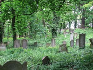
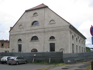
From the mid-16th century until 1945, the region was predominantly Protestant. Jews constituted the most culturally significant religious minority. Every town and every small market town had a Jewish community. As a result of the 1812 Emancipation Edict, a wave of emigration to the west began in the 19th century, alongside the assimilation of the remaining Jews, with the result that by the time the National Socialists dissolved the Jewish communities in 1939, some of them no longer existed.
The Catholic minority was concentrated primarily in the eastern parts of the region, on the border with Greater Poland. Since the region was resettled with a Polish population from 1945 onwards, Catholics have formed the absolute majority, and most Protestant churches were converted into Roman Catholic ones. Today, there are only a few small Protestant congregations and a single newly established Jewish one, in Sorau. The largest religious and cultural minority in the Lubusz Voivodeship is made up of Orthodox Christians of Ruthenian origin, who were forcibly resettled from south-eastern Poland in 1947.
The Viadrina University in Frankfurt, founded in 1506 (Oder), was both an expression and a catalyst of the growing need for knowledge and education that had been developing amongst the nobility and the emerging middle classes since the Renaissance, and provided the region with an intellectual and cultural focus, which was also reflected in the printing industry based there. In 1811, the university was relocated to Breslau. Frankfurt remained an economic and administrative centre, although the educated middle classes increasingly looked to Berlin for intellectual inspiration. In 1991, the Viadrina University was re-established; today, it also attracts many students from the Lubusz Voivodeship. Other significant universities or academic centres are located in Gorzów Wielkopolski, Zielona Góra and Słubice.
Culture of Remembrance
The renaming of the region as ‘Lebuser Land’ should be interpreted as an expression of the Polonisation pushed through by the Polish Communist government. For several decades, this entailed a politically mandated separation from the region’s German history, which made it difficult for the new Polish inhabitants to put down roots in their new home. Since the political upheaval of 1989–1990, there has been a marked increase in regional identity and interest in the region’s history. The residents’ commitment to establishing their own voivodeship – which, since the administrative reform of 1998, has once again borne the name ‘Lubusz Land’ – is a sign that more and more people regard the region as their home and identify with it.
Bibliography
- Magdalena Abraham-Diefenbach, Juliane Tomann, Bernd Vogenbeck (eds.): Terra Transoderana. Between Neumark and Ziemia Lubuska. Berlin 2008 (Almanac – Rediscovering European Border Regions 1).
- Marta J. Bąkiewicz (ed.): On the Middle Oder. A Cultural Landscape in the German–Polish Border Region. Paderborn 2016.
- Zbigniew Czarnuch: Ujarzmienie Rzeki. Człowiek i woda w rejonie ujścia Warty [The Taming of the Rivers. Man and Water in the Warta Estuary Region]. Górzyca, Gorzów Wielkopolski 2008.
- Christian Gahlbeck (ed.): Archive Guide to the History of Eastern Brandenburg up to 1945. Munich 2007 (Publications of the Federal Institute for Culture and History of the Germans in Eastern Europe 31).
- Beata Halicka: Poland’s Wild West. Forced Migration and the Cultural Appropriation of the Oder Region 1945–1948. Paderborn 2013. Polish edition: Polski Dziki Zachód. Przymusowe migracje i kulturowe oswajanie Nadodrza 1945–1948. Kraków 2015.
- Gerd Heinrich (ed.): Cultural Atlas of Brandenburg. Historical Maps. An Overview of the History of the Mark. 2nd, expanded and revised edition. Berlin 2006.
- Gerd-Ulrich Herrmann, Uwe Klar: The Key to Berlin. Background, Preparation and Course of the Battle for the Seelow Heights. Aachen 2010.
- Kerstin Hinrichsen: The Invention of Ziemia Lubuska. The Construction and Appropriation of a Polish Region 1945–1975. Göttingen 2017.
- Heinz W. Linke, Heinz Paschke: The Sternberg Region Through the Ages. Iserlohn 1988.
- Stanisław Lisiecki: The Open Border. Research Report on the Polish–German Border Region (1991–1993). Potsdam 1996.
- Jörg Lüderitz: The Neumark. Through the ancient cultural landscape east of the Oder. 4th updated and expanded edition. Berlin 2008.
- Maria Rutowska, Maria Tomczak: Ziemia Lubuska jako region kulturowy [The Lubusz Land as a Cultural Landscape]. Poznań 2003.
- Edward Rymar: A Key to the Polish Lands, or The History of the Lubusz Land up to its Loss by the Piasts and the Consolidation of the Power of the Margraves of Brandenburg [A Key to the Polish Lands, or The History of the Lubusz Land up to its Loss by the Piasts and the Consolidation of the Rule of the Brandenburg Margraves]. Gorzów Wielkopolski 2007.
- Karl Schlögel, Beata Halicka (eds.): Oder-Odra. Perspectives on a European River. Frankfurt am Main 2007.
- Andrzej Toczewski: Ziemia Lubuska. Studies on the Identity of the Region. Zielona Góra 2014.
- Marceli Tureczek: Ziemia Lubuska. Społeczny wymiar dialogu o przeszłości i tożsamości [The Lubusz Region. The Social Dimension of the Dialogue on the Past and Identity]. Międzyrzecz et al. 2014.
- Eduard Ludwig Wedekind: History of the Neumark of Brandenburg and the districts of Lebus, Sternberg, Züllichau-Schwiebus, Krossen and Kottbus incorporated into it. Berlin, Küstrin 1848.
Web links
- Nowa Marchia – A Forgotten Province – Shared Roots. The Neumark – A Forgotten Province – Shared Roots. Edited by the Voivodeship and Municipal Library in Gorzów Wielkopolski and the Brandenburg Foundation in Fürstenwalde (2004 onwards): www.wimbp.gorzow.pl/?d=4268
- Studia Zielonogórskie [Zielona Góra Studies]. Edited by the Museum of the Lubusz Land in Zielona Góra (1995 onwards): mzl.zgora.pl/kiosk/publikacje/wydawnictwa-ciagle/studia-zielonogorskie/
Notes
[1] As a result of the straightening of the River Oder in the 18th century, a small part of the Neumark now lies to the west of the river’s course: the Oderbruch, which belongs to the Federal Republic of Germany. The historic border here is the Alte Oder.
[2] In some cases, the districts of Friedeberg (Neumark) (Strzelce Krajeńskie) and Netzekreis, which were annexed to Pomerania in 1938, are also included.
[3] Herrmann, Klar: The Key to Berlin. Herrmann, the former director of the Seelower Höhen Memorial, points out that there is still a significant, presumably very high, number of unreported cases; furthermore, the Polish victims have not yet been included in the count.
[4] The population figure for 1939 refers to the territory of the Zielonogórskie Voivodeship within the borders of 1950–1975. It has been extrapolated from the statistical data of the German Reich. Source: Hans Joachim von Koerber: The Population of the German Eastern Territories under Polish Administration. Berlin 1958, p. 233.
The population figures for the years 1946–1992 refer to the slightly larger territories of the Zielonogórskie and Gorzowskie Voivodeships within the borders of 1975–1998 and have also been partly extrapolated. Source: Lisiecki: The Open Border, p. 144.
Citation
Beata Halicka, Matthias Diefenbach: Neumark/East Brandenburg/Ziemia Lubuska. In: Online Encyclopaedia on the Culture and History of Germans in Eastern Europe, 2018. URL: ome-lexikon.uni-oldenburg.de/p38427 (as at 20 May 2021).
Terms of use for this article
Copyright © University of Oldenburg and the Federal Institute for the Culture and History of Germans in Eastern Europe (BKGE), all rights reserved. This work was produced as part of the project ‘Online Encyclopaedia on the Culture and History of Germans in Eastern Europe’ and may be reproduced and published provided the rights holders’ consent has been obtained. Please contact:
If you have any specialist comments or additions to the text, please contact the editorial team, citing relevant literature and source references.